
Lakshmipuram topographic map
Interactive map
Click on the map to display elevation.
About this map
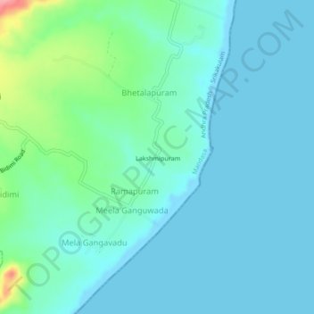
Name: Lakshmipuram topographic map, elevation, terrain.
Location: Lakshmipuram, Srikakulam, Andhra Pradesh, India (18.77594 84.52705 18.81594 84.56705)
Average elevation: 19 m
Minimum elevation: -2 m
Maximum elevation: 109 m