
Modautal topographic map
Interactive map
Click on the map to display elevation.
About this map
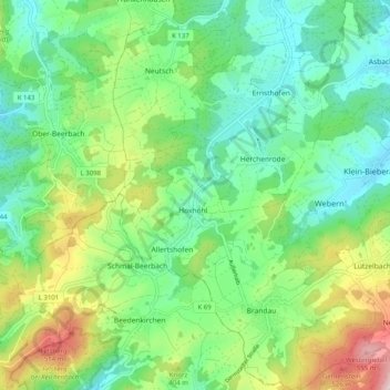
Name: Modautal topographic map, elevation, terrain.
Location: Modautal, Landkreis Darmstadt-Dieburg, Hessen, 64397, Duitsland (49.72222 8.69977 49.78713 8.79057)
Average elevation: 335 m
Minimum elevation: 221 m
Maximum elevation: 587 m
Other topographic maps
Click on a map to view its topography, its elevation and its terrain.
Modautal
Duitsland > Hessen > Landkreis Darmstadt-Dieburg
Modautal, Landkreis Darmstadt-Dieburg, Hessen, 64397, Duitsland
Average elevation: 214 m