
Wohnstadt topographic map
Interactive map
Click on the map to display elevation.
About this map
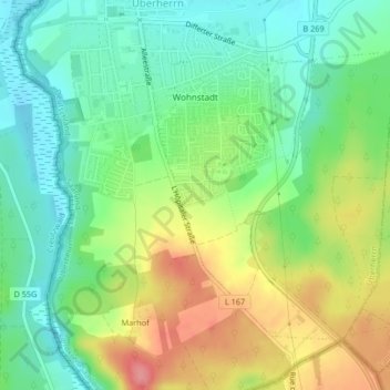
Name: Wohnstadt topographic map, elevation, terrain.
Location: Wohnstadt, Überherrn, Landkreis Saarlouis, Saarland, Deutschland (49.22134 6.69982 49.24137 6.72534)
Average elevation: 231 m
Minimum elevation: 196 m
Maximum elevation: 286 m
Other topographic maps
Click on a map to view its topography, its elevation and its terrain.
Berus
Deutschland > Saarland > Überherrn
Berus, Überherrn, Landkreis Saarlouis, Saarland, Deutschland
Average elevation: 250 m