
La Gomera topographic map
Interactive map
Click on the map to display elevation.
About this map
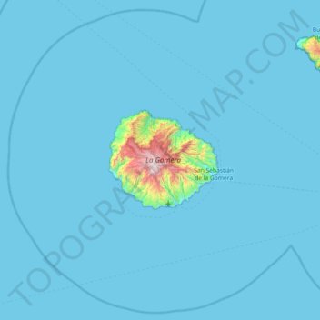
Name: La Gomera topographic map, elevation, terrain.
Average elevation: 42 m
Minimum elevation: 0 m
Maximum elevation: 1,439 m
Other topographic maps
Click on a map to view its topography, its elevation and its terrain.
Hermigua
Spanien > Kanarische Inseln > Hermigua > Hermigua
Hermigua, Santa Cruz de Tenerife, Kanarische Inseln, 38820, Spanien
Average elevation: 645 m