
Logerie topographic map
Interactive map
Click on the map to display elevation.
About this map
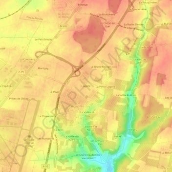
Name: Logerie topographic map, elevation, terrain.
Average elevation: 104 m
Minimum elevation: 63 m
Maximum elevation: 121 m
Other topographic maps
Click on a map to view its topography, its elevation and its terrain.
Le Papillon
France > Centre-Val de Loire > Indre-et-Loire > Parçay-Meslay
Le Papillon, Parçay-Meslay, Tours, Indre-et-Loire, Centre-Val de Loire, France métropolitaine, 37210, France
Average elevation: 103 m
La Petite Logerie
France > Centre-Val de Loire > Indre-et-Loire > Parçay-Meslay > La Petite Logerie
La Petite Logerie, Parçay-Meslay, Tours, Indre-et-Loire, Centre-Val de Loire, France métropolitaine, 37210, France
Average elevation: 105 m