
Thank you for supporting this site ❤️
Make a donation
Make a donation
Mwingi topographic map
Click on the map to display elevation.
Thank you for supporting this site ❤️
Make a donation
Make a donation
About this map
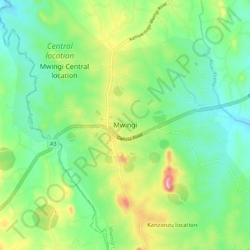
Name: Mwingi topographic map, elevation, terrain.
Location: Mwingi, Kitui County, East Kenya, 90400, Kenya (-0.97330 38.02660 -0.89330 38.10660)
Average elevation: 972 m
Minimum elevation: 899 m
Maximum elevation: 1,126 m
Thank you for supporting this site ❤️
Make a donation
Make a donation
Other topographic maps
Click on a map to view its topography, its elevation and its terrain.