
Thank you for supporting this site ❤️
Make a donation
Make a donation
Lake Cook topographic map
Click on the map to display elevation.
Thank you for supporting this site ❤️
Make a donation
Make a donation
About this map
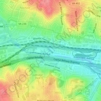
Name: Lake Cook topographic map, elevation, terrain.
Location: Lake Cook, Lyles-Crouch, Alexandria, Virginia, United States (38.80433 -77.10144 38.80586 -77.09737)
Average elevation: 35 m
Minimum elevation: 0 m
Maximum elevation: 81 m
Thank you for supporting this site ❤️
Make a donation
Make a donation