
Pizol topographic map
Interactive map
Click on the map to display elevation.
About this map
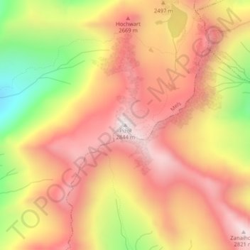
Name: Pizol topographic map, elevation, terrain.
Location: Pizol, Mels, Wahlkreis Sarganserland, Sankt Gallen, Schweiz (46.95910 9.38667 46.95920 9.38677)
Average elevation: 2,439 m
Minimum elevation: 1,871 m
Maximum elevation: 2,803 m
Other topographic maps
Click on a map to view its topography, its elevation and its terrain.
Chapfensee
Schweiz > Sankt Gallen > Wahlkreis Sarganserland > Mels > Mädris
Chapfensee, Mädris, Mels, Wahlkreis Sarganserland, Sankt Gallen, Schweiz
Average elevation: 932 m