
Thank you for supporting this site ❤️
Make a donation
Make a donation
Manston topographic map
Click on the map to display elevation.
Thank you for supporting this site ❤️
Make a donation
Make a donation
About this map
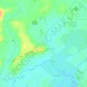
Name: Manston topographic map, elevation, terrain.
Location: Manston, Dorset, England, United Kingdom (50.92782 -2.29219 50.95390 -2.24423)
Average elevation: 51 m
Minimum elevation: 42 m
Maximum elevation: 71 m
Thank you for supporting this site ❤️
Make a donation
Make a donation
Other topographic maps
Click on a map to view its topography, its elevation and its terrain.
Thank you for supporting this site ❤️
Make a donation
Make a donation
Thank you for supporting this site ❤️
Make a donation
Make a donation