
Flagstaff topographic map
Interactive map
Click on the map to display elevation.
About this map
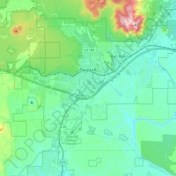
Name: Flagstaff topographic map, elevation, terrain.
Location: Flagstaff, Coconino County, Arizona, États-Unis d'Amérique (35.12240 -111.70894 35.24010 -111.50678)
Average elevation: 2,176 m
Minimum elevation: 2,008 m
Maximum elevation: 2,830 m
Other topographic maps
Click on a map to view its topography, its elevation and its terrain.
Grand Canyon
États-Unis d'Amérique > Arizona > Coconino County
Grand Canyon, Coconino County, Arizona, États-Unis d'Amérique
Average elevation: 1,021 m