
Thank you for supporting this site ❤️
Make a donation
Make a donation
Haledon topographic map
Click on the map to display elevation.
Thank you for supporting this site ❤️
Make a donation
Make a donation
About this map
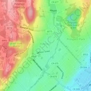
Name: Haledon topographic map, elevation, terrain.
Location: Haledon, Passaic County, New Jersey, United States (40.92333 -74.20333 40.94689 -74.17469)
Average elevation: 81 m
Minimum elevation: 14 m
Maximum elevation: 166 m
Thank you for supporting this site ❤️
Make a donation
Make a donation
Other topographic maps
Click on a map to view its topography, its elevation and its terrain.
Thank you for supporting this site ❤️
Make a donation
Make a donation
Thank you for supporting this site ❤️
Make a donation
Make a donation