
Thank you for supporting this site ❤️
Make a donation
Make a donation
Tarxien topographic map
Click on the map to display elevation.
Thank you for supporting this site ❤️
Make a donation
Make a donation
About this map
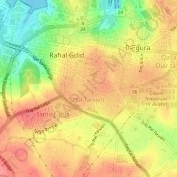
Name: Tarxien topographic map, elevation, terrain.
Location: Tarxien, South Eastern Region, Malta (35.86150 14.50585 35.87156 14.52065)
Average elevation: 46 m
Minimum elevation: 0 m
Maximum elevation: 75 m
Thank you for supporting this site ❤️
Make a donation
Make a donation