
Inkhundla Mhlume topographic map
Interactive map
Click on the map to display elevation.
About this map
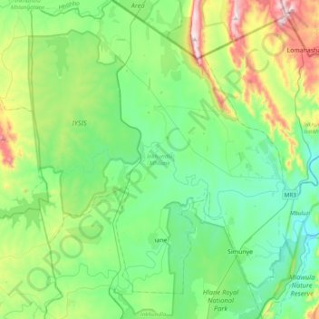
Name: Inkhundla Mhlume topographic map, elevation, terrain.
Location: Inkhundla Mhlume, Lubombo, Eswatini (-26.28147 31.66612 -25.93590 32.03406)
Average elevation: 301 m
Minimum elevation: 131 m
Maximum elevation: 797 m
Other topographic maps
Click on a map to view its topography, its elevation and its terrain.
Mhlume
Eswatini > Lubombo > Inkhundla Mhlume
Mhlume, Inkhundla Mhlume, Lubombo, Eswatini
Average elevation: 263 m