
Thank you for supporting this site ❤️
Make a donation
Make a donation
Glenmore topographic map
Click on the map to display elevation.
Thank you for supporting this site ❤️
Make a donation
Make a donation
About this map
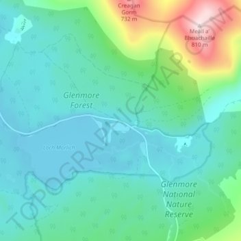
Name: Glenmore topographic map, elevation, terrain.
Location: Glenmore, Highland, Scotland, PH22 1QY, United Kingdom (57.14775 -3.71527 57.18775 -3.67527)
Average elevation: 414 m
Minimum elevation: 316 m
Maximum elevation: 807 m
Thank you for supporting this site ❤️
Make a donation
Make a donation
Other topographic maps
Click on a map to view its topography, its elevation and its terrain.