
Nyeri topographic map
Interactive map
Click on the map to display elevation.
About this map
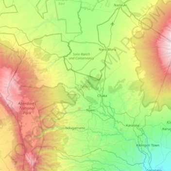
Name: Nyeri topographic map, elevation, terrain.
Location: Nyeri, Kenia (-0.64687 36.60474 0.01042 37.30854)
Average elevation: 2,218 m
Minimum elevation: 1,162 m
Maximum elevation: 4,339 m
Other topographic maps
Click on a map to view its topography, its elevation and its terrain.