
Kikvi topographic map
Interactive map
Click on the map to display elevation.
About this map
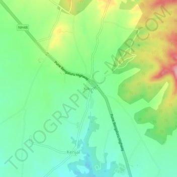
Name: Kikvi topographic map, elevation, terrain.
Location: Kikvi, Bhor, Pune, Maharashtra, India (18.18090 73.92406 18.22090 73.96406)
Average elevation: 627 m
Minimum elevation: 572 m
Maximum elevation: 730 m
Other topographic maps
Click on a map to view its topography, its elevation and its terrain.
Rohida Fort
India > Maharashtra > Bhor > Hathnoshi
Rohida Fort, SH63, Hathnoshi, Bhor, Maharashtra, 412206, India
Average elevation: 806 m
Raireshwar Fort
India > Maharashtra > Bhor
Raireshwar Fort, Kenjalgad trail, Bhor, Pune District, Maharashtra, India
Average elevation: 1,145 m
Bhor
India > Maharashtra > Bhor
Bhor, Pune District, Maharashtra, 412206, India
Average elevation: 650 m