
Thank you for supporting this site ❤️
Make a donation
Make a donation
Hamden topographic map
Click on the map to display elevation.
Thank you for supporting this site ❤️
Make a donation
Make a donation
About this map
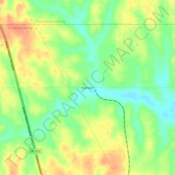
Name: Hamden topographic map, elevation, terrain.
Location: Hamden, Choctaw County, Oklahoma, United States (34.12232 -95.58663 34.16232 -95.54663)
Average elevation: 158 m
Minimum elevation: 135 m
Maximum elevation: 180 m
Thank you for supporting this site ❤️
Make a donation
Make a donation
Other topographic maps
Click on a map to view its topography, its elevation and its terrain.