
Vukël topographic map
Interactive map
Click on the map to display elevation.
About this map
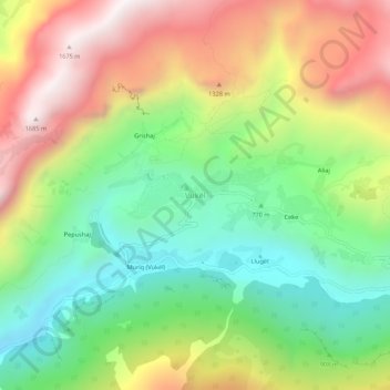
Name: Vukël topographic map, elevation, terrain.
Location: Vukël, Bashkia Malësi e Madhe, Shkodër County, 4304, Albania (42.46620 19.62735 42.50620 19.66735)
Average elevation: 983 m
Minimum elevation: 474 m
Maximum elevation: 1,659 m