
Crawfordville topographic map
Interactive map
Click on the map to display elevation.
About this map
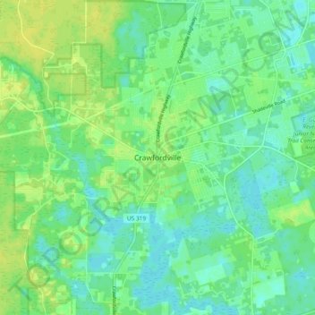
Name: Crawfordville topographic map, elevation, terrain.
Location: Crawfordville, Wakulla County, Florida, 32326, USA (30.13604 -84.41518 30.21604 -84.33518)
Average elevation: 9 m
Minimum elevation: 1 m
Maximum elevation: 18 m