
Thank you for supporting this site ❤️
Make a donation
Make a donation
Moses Lake topographic map
Click on the map to display elevation.
Thank you for supporting this site ❤️
Make a donation
Make a donation
About this map
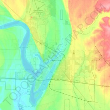
Name: Moses Lake topographic map, elevation, terrain.
Location: Moses Lake, Grant County, Washington, 98837, United States (47.05708 -119.36364 47.21843 -119.17880)
Average elevation: 350 m
Minimum elevation: 314 m
Maximum elevation: 416 m
Thank you for supporting this site ❤️
Make a donation
Make a donation
Other topographic maps
Click on a map to view its topography, its elevation and its terrain.