
Zhongyuan District topographic map
Interactive map
Click on the map to display elevation.
About this map
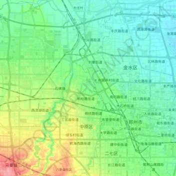
Name: Zhongyuan District topographic map, elevation, terrain.
Location: Zhongyuan District, Zhengzhou, Henan, China (34.70527 113.44596 34.86078 113.62677)
Average elevation: 109 m
Minimum elevation: 86 m
Maximum elevation: 171 m
Other topographic maps
Click on a map to view its topography, its elevation and its terrain.