
Rickenbach (TG) topographic map
Interactive map
Click on the map to display elevation.
About this map
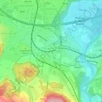
Name: Rickenbach (TG) topographic map, elevation, terrain.
Location: Rickenbach (TG), Bezirk Münchwilen, Thurgau, 9532, Schweiz (47.44014 9.03624 47.45385 9.06255)
Average elevation: 563 m
Minimum elevation: 510 m
Maximum elevation: 682 m
Other topographic maps
Click on a map to view its topography, its elevation and its terrain.
Tobel
Schweiz > Thurgau > Bezirk Münchwilen > Tobel-Tägerschen
Tobel, Tobel-Tägerschen, Bezirk Münchwilen, Thurgau, 9555, Schweiz
Average elevation: 545 m
Aadorf
Schweiz > Thurgau > Bezirk Münchwilen
Aadorf, Bezirk Münchwilen, Thurgau, 8355, Schweiz
Average elevation: 556 m