
Thank you for supporting this site ❤️
Make a donation
Make a donation
Keriya County topographic map
Click on the map to display elevation.
Thank you for supporting this site ❤️
Make a donation
Make a donation
About this map
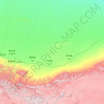
Name: Keriya County topographic map, elevation, terrain.
Location: Keriya County, Hotan Prefecture, Xinjiang, 848400, China (35.23462 81.12236 39.48497 82.78992)
Average elevation: 2,410 m
Minimum elevation: 1,025 m
Maximum elevation: 6,908 m
Thank you for supporting this site ❤️
Make a donation
Make a donation
Other topographic maps
Click on a map to view its topography, its elevation and its terrain.