
Isla Cozumel topographic map
Interactive map
Click on the map to display elevation.
About this map
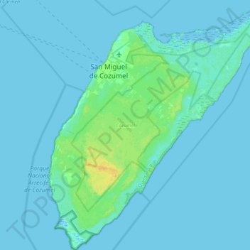
Name: Isla Cozumel topographic map, elevation, terrain.
Location: Isla Cozumel, Cozumel, Quintana Roo, México (20.27200 -87.02520 20.59200 -86.72328)
Average elevation: 2 m
Minimum elevation: -3 m
Maximum elevation: 18 m