
Thank you for supporting this site ❤️
Make a donation
Make a donation
Edakunnu topographic map
Click on the map to display elevation.
Thank you for supporting this site ❤️
Make a donation
Make a donation
About this map
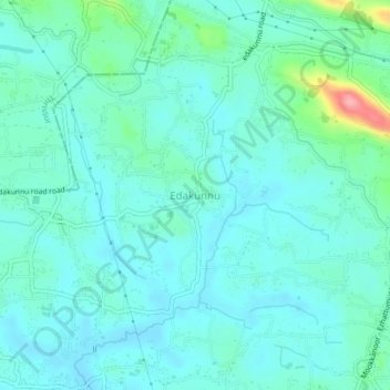
Name: Edakunnu topographic map, elevation, terrain.
Location: Edakunnu, Aluva, Ernakulam, Kerala, 683577, India (10.23469 76.38382 10.27469 76.42382)
Average elevation: 26 m
Minimum elevation: 6 m
Maximum elevation: 117 m
Thank you for supporting this site ❤️
Make a donation
Make a donation
Other topographic maps
Click on a map to view its topography, its elevation and its terrain.