
Jayabima topographic map
Interactive map
Click on the map to display elevation.
About this map
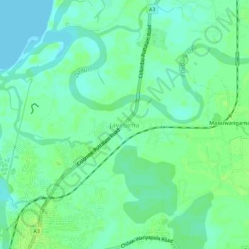
Name: Jayabima topographic map, elevation, terrain.
Location: Jayabima, Puttalam District, North Western Province, Sri Lanka (7.57919 79.79022 7.61919 79.83022)
Average elevation: 6 m
Minimum elevation: 0 m
Maximum elevation: 11 m
Other topographic maps
Click on a map to view its topography, its elevation and its terrain.
Feeder Canal to Bathalagoda Lake from Daduru Oya Anicut
Sri Lanka > North Western Province > Kurunegala
Average elevation: 127 m