
Mahananda topographic map
Click on the map to display elevation.
About this map
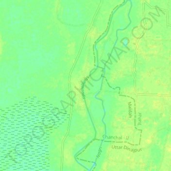
Name: Mahananda topographic map, elevation, terrain.
Location: Mahananda, Chanchal - II, Maldah, West Bengal, India (25.28382 88.10125 25.34213 88.12108)
Average elevation: 27 m
Minimum elevation: 18 m
Maximum elevation: 33 m
Other topographic maps
Click on a map to view its topography, its elevation and its terrain.