
Make a donation
Arlington topographic map
Click on the map to display elevation.
Make a donation
Arlington
The city lies on a glacial terrace formed during the Pleistocene epoch by the recession of the Cordilleran Ice Sheet. Arlington covers a series of hills that sit at an elevation of 100 to 200 feet (30 to 61 m) above sea level. Downtown Arlington is situated on a bluff above the confluence of the Stillaguamish River and its North and South Forks. Most of Arlington sits in the watersheds of the Stillaguamish River, Portage Creek, and Quilceda Creek. From various points in Arlington, the Olympic Mountains, Mount Pilchuck, and Mount Rainier are visible on the horizon.
Make a donation
About this map
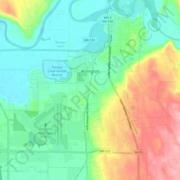
Name: Arlington topographic map, elevation, terrain.
Average elevation: 60 m
Minimum elevation: 6 m
Maximum elevation: 172 m
Make a donation
Other topographic maps
Click on a map to view its topography, its elevation and its terrain.