
Bajč topographic map
Interactive map
Click on the map to display elevation.
About this map
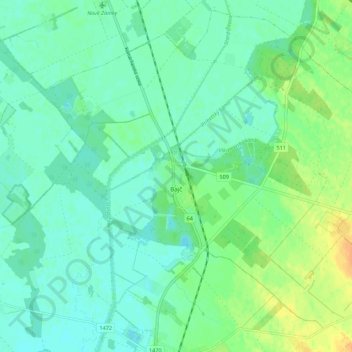
Name: Bajč topographic map, elevation, terrain.
Average elevation: 117 m
Minimum elevation: 108 m
Maximum elevation: 137 m
The village lies at an altitude of 121 metres and covers an area of 36.476 km2 (14.08 sq mi). It has a population of about 1,240 people.
Other topographic maps
Click on a map to view its topography, its elevation and its terrain.
Komárno
Slovakia > Region of Nitra > District of Komárno
Komárno, District of Komárno, Region of Nitra, Western Slovakia, Slovakia
Average elevation: 111 m