
Amposta topographic map
Interactive map
Click on the map to display elevation.
About this map
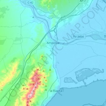
Name: Amposta topographic map, elevation, terrain.
Location: Amposta, Montsià, Tarragone, Catalogne, 43870, Espagne (40.62546 0.53258 40.75177 0.79539)
Average elevation: 67 m
Minimum elevation: -5 m
Maximum elevation: 747 m
Other topographic maps
Click on a map to view its topography, its elevation and its terrain.
Parc Natural del Delta de l'Ebre
Espagne > Catalogne > Montsià > la Ràpita
Parc Natural del Delta de l'Ebre, la Ràpita, Montsià, Tarragone, Catalogne, 43540, Espagne
Average elevation: 40 m