
Thank you for supporting this site ❤️
Make a donation
Make a donation
Tallapalem topographic map
Click on the map to display elevation.
Thank you for supporting this site ❤️
Make a donation
Make a donation
About this map
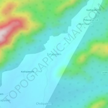
Name: Tallapalem topographic map, elevation, terrain.
Location: Tallapalem, Koyyuru, Andhra Pradesh, India (17.65482 82.21878 17.69482 82.25878)
Average elevation: 366 m
Minimum elevation: 261 m
Maximum elevation: 798 m
Thank you for supporting this site ❤️
Make a donation
Make a donation