
Waterton Lakes National Park topographic map
Interactive map
Click on the map to display elevation.
About this map
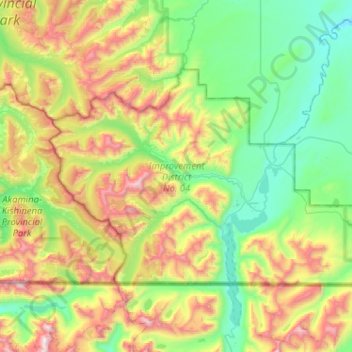
Name: Waterton Lakes National Park topographic map, elevation, terrain.
Average elevation: 1,778 m
Minimum elevation: 1,214 m
Maximum elevation: 3,030 m
Operated by Parks Canada, Waterton is open all year, but the main tourist season is during July and August. The only commercial facilities available within the park are located at the Waterton Park townsite. This park ranges in elevation from 1,290 metres (4,232 ft) at the townsite to 2,910 m (9,547 ft) at Mount Blakiston. It offers many scenic trails, including Crypt Lake trail. In 2012/2013, Waterton Lakes National Park had 402,542 visitors.