
Truyère topographic map
Interactive map
Click on the map to display elevation.
About this map
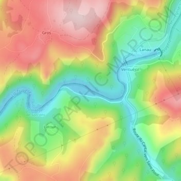
Name: Truyère topographic map, elevation, terrain.
Average elevation: 788 m
Minimum elevation: 638 m
Maximum elevation: 954 m
Other topographic maps
Click on a map to view its topography, its elevation and its terrain.
Truyère
France > Auvergne-Rhône-Alpes > Cantal > Chaudes-Aigues > Ventuéjol
Truyère, Ventuéjol, Neuvéglise, Chaudes-Aigues, Saint-Flour, Cantal, Auvergne-Rhône-Alpes, France métropolitaine, 15110, France
Average elevation: 787 m