
Yakwila topographic map
Interactive map
Click on the map to display elevation.
About this map
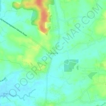
Name: Yakwila topographic map, elevation, terrain.
Location: Yakwila, Kurunegala District, North Western Province, Sri Lanka (7.36038 80.01672 7.40038 80.05672)
Average elevation: 37 m
Minimum elevation: 23 m
Maximum elevation: 69 m
Other topographic maps
Click on a map to view its topography, its elevation and its terrain.
Feeder Canal to Bathalagoda Lake from Daduru Oya Anicut
Sri Lanka > North Western Province > Kurunegala
Average elevation: 127 m