
Wroughton topographic map
Interactive map
Click on the map to display elevation.
About this map
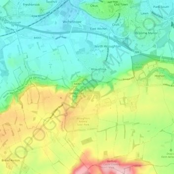
Name: Wroughton topographic map, elevation, terrain.
Location: Wroughton, Swindon, Engeland, Verenigd Koninkrijk (51.48246 -1.84692 51.55323 -1.76425)
Average elevation: 153 m
Minimum elevation: 95 m
Maximum elevation: 269 m