
梅水乡 topographic map
Interactive map
Click on the map to display elevation.
About this map
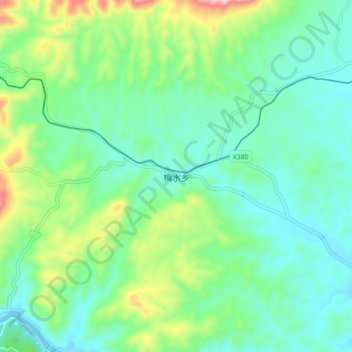
Name: 梅水乡 topographic map, elevation, terrain.
Location: 梅水乡, 上犹县, 赣州市, 江西省, 中国 (25.80921 114.42668 25.88921 114.50668)
Average elevation: 268 m
Minimum elevation: 149 m
Maximum elevation: 617 m
Other topographic maps
Click on a map to view its topography, its elevation and its terrain.