
Thank you for supporting this site ❤️
Make a donation
Make a donation
Bowlegs topographic map
Click on the map to display elevation.
Thank you for supporting this site ❤️
Make a donation
Make a donation
About this map
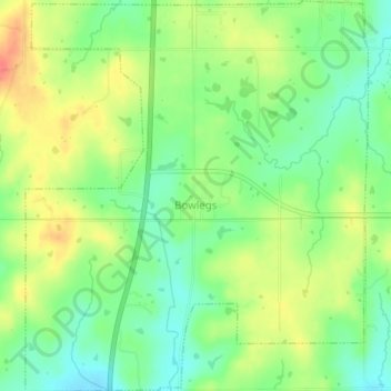
Name: Bowlegs topographic map, elevation, terrain.
Location: Bowlegs, Seminole County, Oklahoma, 74830, United States (35.13032 -96.68771 35.16350 -96.65212)
Average elevation: 287 m
Minimum elevation: 259 m
Maximum elevation: 322 m
Thank you for supporting this site ❤️
Make a donation
Make a donation
Other topographic maps
Click on a map to view its topography, its elevation and its terrain.