
Buscalan topographic map
Interactive map
Click on the map to display elevation.
About this map
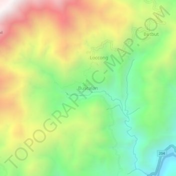
Name: Buscalan topographic map, elevation, terrain.
Average elevation: 1,150 m
Minimum elevation: 533 m
Maximum elevation: 1,973 m
Other topographic maps
Click on a map to view its topography, its elevation and its terrain.
Ambalatungan
Philippinen > Kalinga > Tabuk
Ambalatungan, Tabuk, Kalinga, Cordillera Administrative Region, Philippinen
Average elevation: 1,734 m