
Anfelden topographic map
Interactive map
Click on the map to display elevation.
About this map
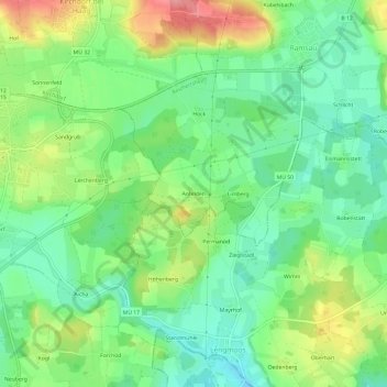
Name: Anfelden topographic map, elevation, terrain.
Average elevation: 521 m
Minimum elevation: 481 m
Maximum elevation: 591 m
Other topographic maps
Click on a map to view its topography, its elevation and its terrain.
Manholding
Deutschland > Bayern > Landkreis Mühldorf am Inn > Reichertsheim
Manholding, Reichertsheim, Reichertsheim (VGem), Landkreis Mühldorf am Inn, Bayern, 84437, Deutschland
Average elevation: 547 m