
Thank you for supporting this site ❤️
Make a donation
Make a donation
Nandi Hills topographic map
Click on the map to display elevation.
Thank you for supporting this site ❤️
Make a donation
Make a donation
About this map
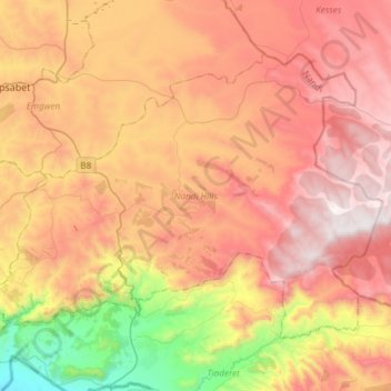
Name: Nandi Hills topographic map, elevation, terrain.
Location: Nandi Hills, Nandi County, Rift Valley, Kenya (0.00793 35.08848 0.22636 35.38752)
Average elevation: 1,983 m
Minimum elevation: 1,235 m
Maximum elevation: 2,599 m
Thank you for supporting this site ❤️
Make a donation
Make a donation