
Thank you for supporting this site ❤️
Make a donation
Make a donation
Zone IV topographic map
Click on the map to display elevation.
Thank you for supporting this site ❤️
Make a donation
Make a donation
About this map
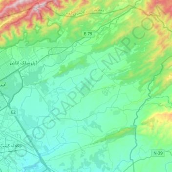
Name: Zone IV topographic map, elevation, terrain.
Location: Zone IV, Islamabad Capital Territory, Pakistan (33.58138 73.08804 33.79905 73.37488)
Average elevation: 647 m
Minimum elevation: 431 m
Maximum elevation: 1,585 m
Thank you for supporting this site ❤️
Make a donation
Make a donation
Other topographic maps
Click on a map to view its topography, its elevation and its terrain.
Islamabad
Pakistan > Islamabad Capital Territory
Islamabad is located at 33°26′N 73°02′E / 33.43°N 73.04°E / 33.43; 73.04 at the northern edge of the Pothohar Plateau and at the foot of the Margalla Hills in Islamabad Capital Territory. Its elevation is 540 metres (1,770 ft). The modern capital and the ancient Gakhar city of Rawalpindi form…
Average elevation: 666 m