
Coleby topographic map
Click on the map to display elevation.
About this map
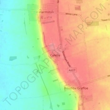
Name: Coleby topographic map, elevation, terrain.
Average elevation: 50 m
Minimum elevation: 8 m
Maximum elevation: 91 m
Other topographic maps
Click on a map to view its topography, its elevation and its terrain.
Sleaford
United Kingdom > England > Lincolnshire > North Kesteven
Although hardly damaged in the First and Second World Wars, Sleaford has close links with the Royal Air Force due to proximity to several RAF bases, including RAF Cranwell and RAF Waddington. Lincolnshire's topography – flat and open countryside – and its location in the east of the country made it ideal…
Average elevation: 18 m