
Thank you for supporting this site ❤️
Make a donation
Make a donation
Sillaröd topographic map
Click on the map to display elevation.
Thank you for supporting this site ❤️
Make a donation
Make a donation
About this map
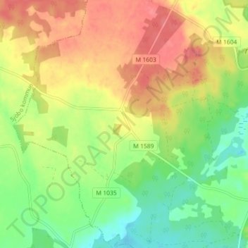
Name: Sillaröd topographic map, elevation, terrain.
Location: Sillaröd, Tomelilla kommun, Skåne County, Sweden (55.69794 13.90144 55.73794 13.94144)
Average elevation: 132 m
Minimum elevation: 99 m
Maximum elevation: 164 m
Thank you for supporting this site ❤️
Make a donation
Make a donation
Other topographic maps
Click on a map to view its topography, its elevation and its terrain.