Iola topographic map
Interactive map
Click on the map to display elevation.
About this map
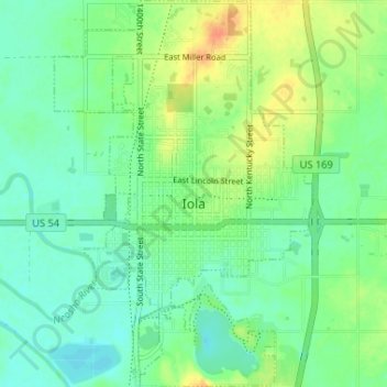
Name: Iola topographic map, elevation, terrain.
Location: Iola, Allen County, Kansas, 66749, United States (37.90013 -95.42344 37.95143 -95.37978)
Average elevation: 296 m
Minimum elevation: 283 m
Maximum elevation: 320 m
Other topographic maps
Click on a map to view its topography, its elevation and its terrain.
Humboldt
United States > Kansas > Allen County
Humboldt, Allen County, Kansas, United States
Average elevation: 293 m
Moran
United States > Kansas > Allen County
Moran, Allen County, Kansas, United States
Average elevation: 334 m
Elsmore
United States > Kansas > Allen County
Elsmore, Allen County, Kansas, United States
Average elevation: 322 m
Bassett
United States > Kansas > Allen County
Bassett, Allen County, Kansas, United States
Average elevation: 294 m
Savonburg
United States > Kansas > Allen County
Savonburg, Allen County, Kansas, United States
Average elevation: 318 m
Gas
United States > Kansas > Allen County
Gas, Allen County, Kansas, 66742, United States
Average elevation: 310 m
La Harpe
United States > Kansas > Allen County
La Harpe, Allen County, Kansas, 66751, United States
Average elevation: 313 m