
Brownsburg topographic map
Interactive map
Click on the map to display elevation.
About this map
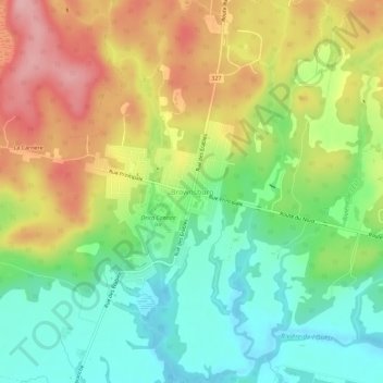
Name: Brownsburg topographic map, elevation, terrain.
Average elevation: 123 m
Minimum elevation: 59 m
Maximum elevation: 207 m
Other topographic maps
Click on a map to view its topography, its elevation and its terrain.
Pine Hill
Canada > Québec > Argenteuil > Brownsburg-Chatham
Pine Hill, Brownsburg-Chatham, Argenteuil, Laurentides, Québec, J8G 1E4, Canada
Average elevation: 273 m
Dalesville
Canada > Québec > Argenteuil > Brownsburg-Chatham
Dalesville, Brownsburg-Chatham, Argenteuil, Laurentides, Québec, J8G 3C4, Canada
Average elevation: 193 m