
Buschberg topographic map
Interactive map
Click on the map to display elevation.
About this map
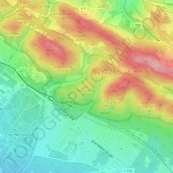
Name: Buschberg topographic map, elevation, terrain.
Location: Buschberg, Bielefeld, Nordrhein-Westfalen, 33659, Deutschland (51.98086 8.54425 51.98096 8.54435)
Average elevation: 200 m
Minimum elevation: 130 m
Maximum elevation: 296 m