
Thank you for supporting this site ❤️
Make a donation
Make a donation
Tungarli topographic map
Click on the map to display elevation.
Thank you for supporting this site ❤️
Make a donation
Make a donation
About this map
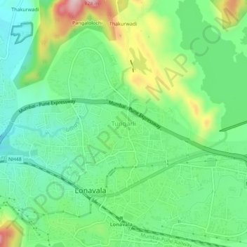
Name: Tungarli topographic map, elevation, terrain.
Location: Tungarli, Mawal, Pune District, Maharashtra, 410403, India (18.74574 73.38738 18.78574 73.42738)
Average elevation: 630 m
Minimum elevation: 538 m
Maximum elevation: 819 m
Thank you for supporting this site ❤️
Make a donation
Make a donation
Other topographic maps
Click on a map to view its topography, its elevation and its terrain.