
Thank you for supporting this site ❤️
Make a donation
Make a donation
Silecroft topographic map
Click on the map to display elevation.
Thank you for supporting this site ❤️
Make a donation
Make a donation
About this map
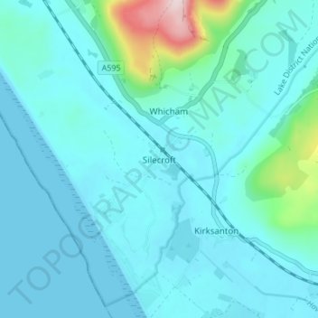
Name: Silecroft topographic map, elevation, terrain.
Location: Silecroft, Cumberland, England, LA18 4NR, United Kingdom (54.20487 -3.35542 54.24487 -3.31542)
Average elevation: 44 m
Minimum elevation: 0 m
Maximum elevation: 356 m
Thank you for supporting this site ❤️
Make a donation
Make a donation
Other topographic maps
Click on a map to view its topography, its elevation and its terrain.