
Böckten topographic map
Interactive map
Click on the map to display elevation.
About this map
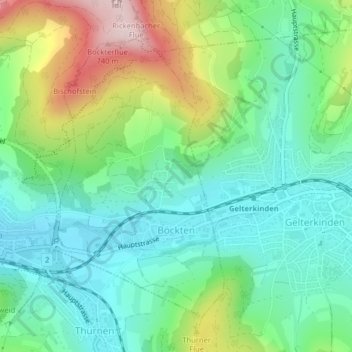
Name: Böckten topographic map, elevation, terrain.
Location: Böckten, Bezirk Sissach, Basel-Landschaft, 4461, Schweiz (47.45674 7.82454 47.47827 7.84418)
Average elevation: 486 m
Minimum elevation: 373 m
Maximum elevation: 741 m