
Jakobshorn topographic map
Interactive map
Click on the map to display elevation.
About this map
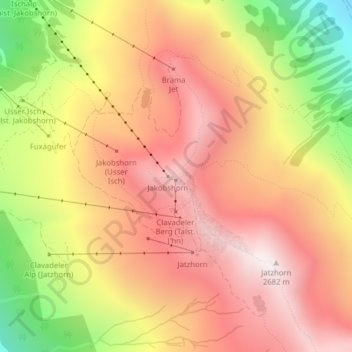
Name: Jakobshorn topographic map, elevation, terrain.
Location: Jakobshorn, Davos, Prättigau/Davos, Graubünden, 7270, Schweiz (46.77235 9.84929 46.77245 9.84939)
Average elevation: 2,238 m
Minimum elevation: 1,606 m
Maximum elevation: 2,657 m
Other topographic maps
Click on a map to view its topography, its elevation and its terrain.
Unter-Laret
Schweiz > Graubünden > Prättigau/Davos > Davos
Unter-Laret, Davos, Prättigau/Davos, Graubünden, 7265, Schweiz
Average elevation: 1,757 m